On our 3rd and final full day on Easter Island we had two more excursions. First up was a trip to a petroglyph site, Papa Vaka, which has several marine figures etched into the rock.

You can clearly see the tuna and a shark on this rock. It’s best to visit this site in the morning when the sun is lower in the sky, hence making this our first stop.

These carvings are said to represent a squid and an assortment of fish hooks.

The largest petroglyph at the site is supposed to be a a double-hulled canoe, likely meant to represent the type of craft that brought the first Polynesians to Rapa Nui, likely from Tahiti.

We took a short hike along the shoreline, and two local dogs followed us the entire way. It seems everybody here lets their dogs run free.

The scenery is stunning!
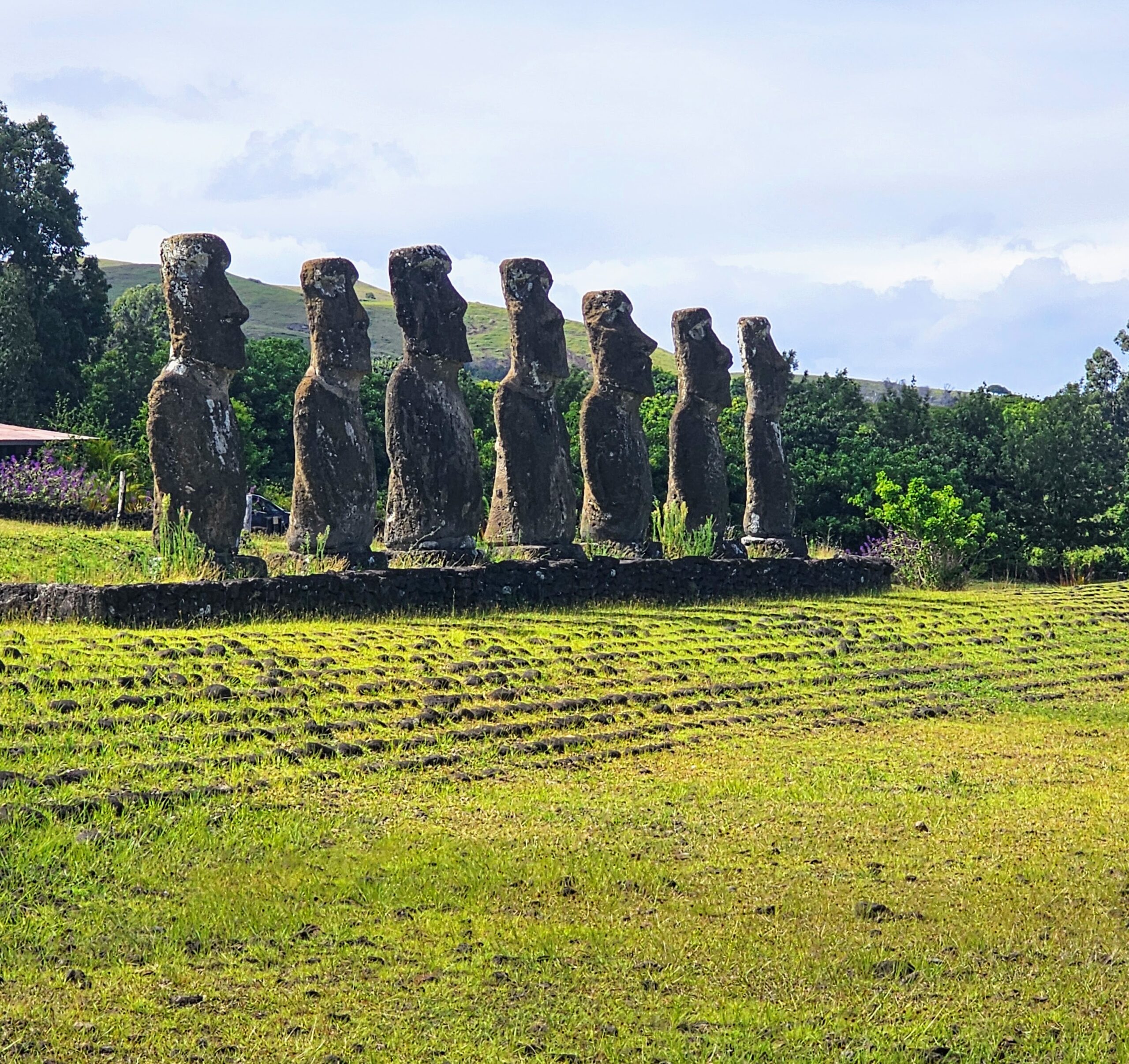
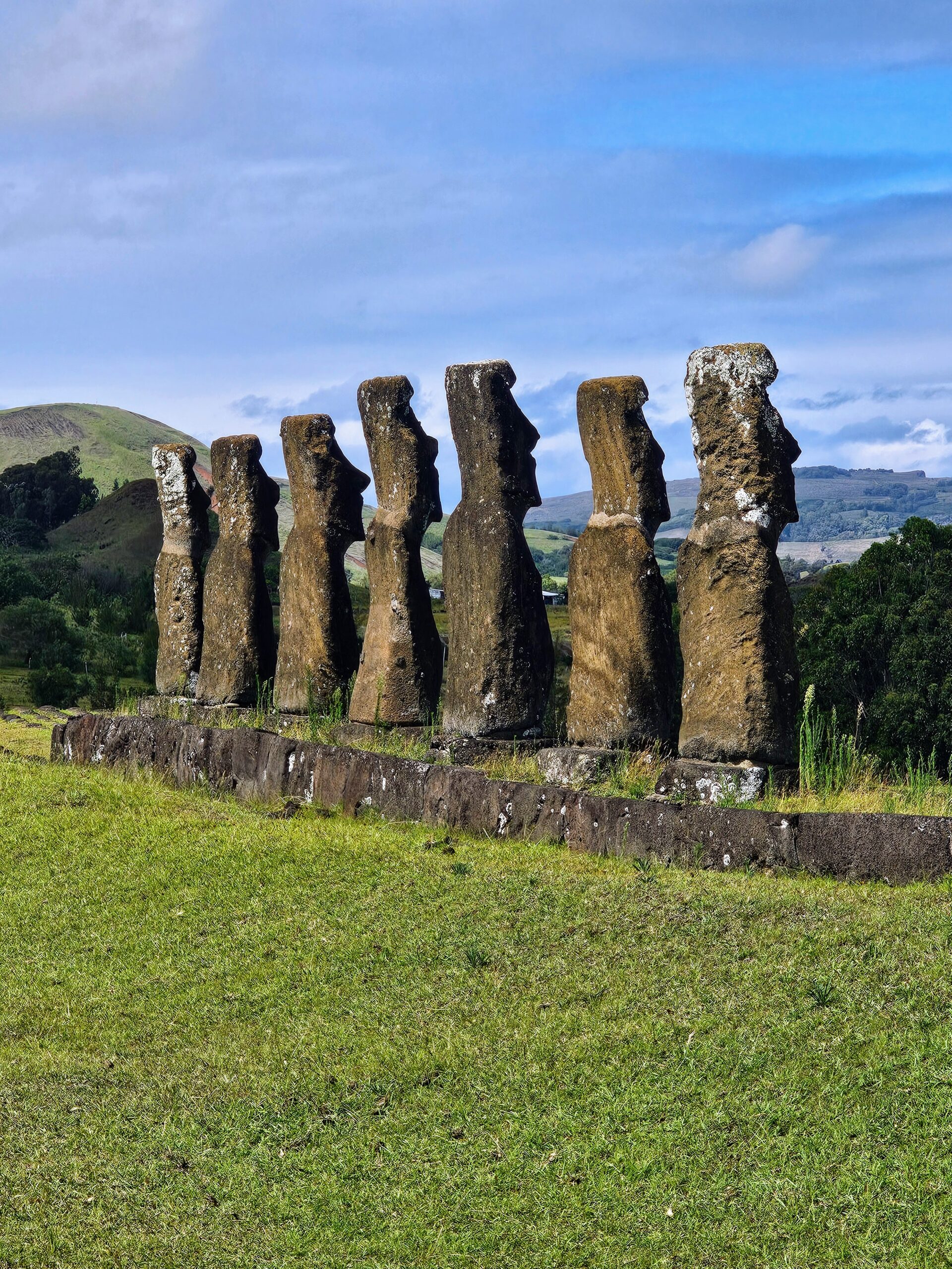
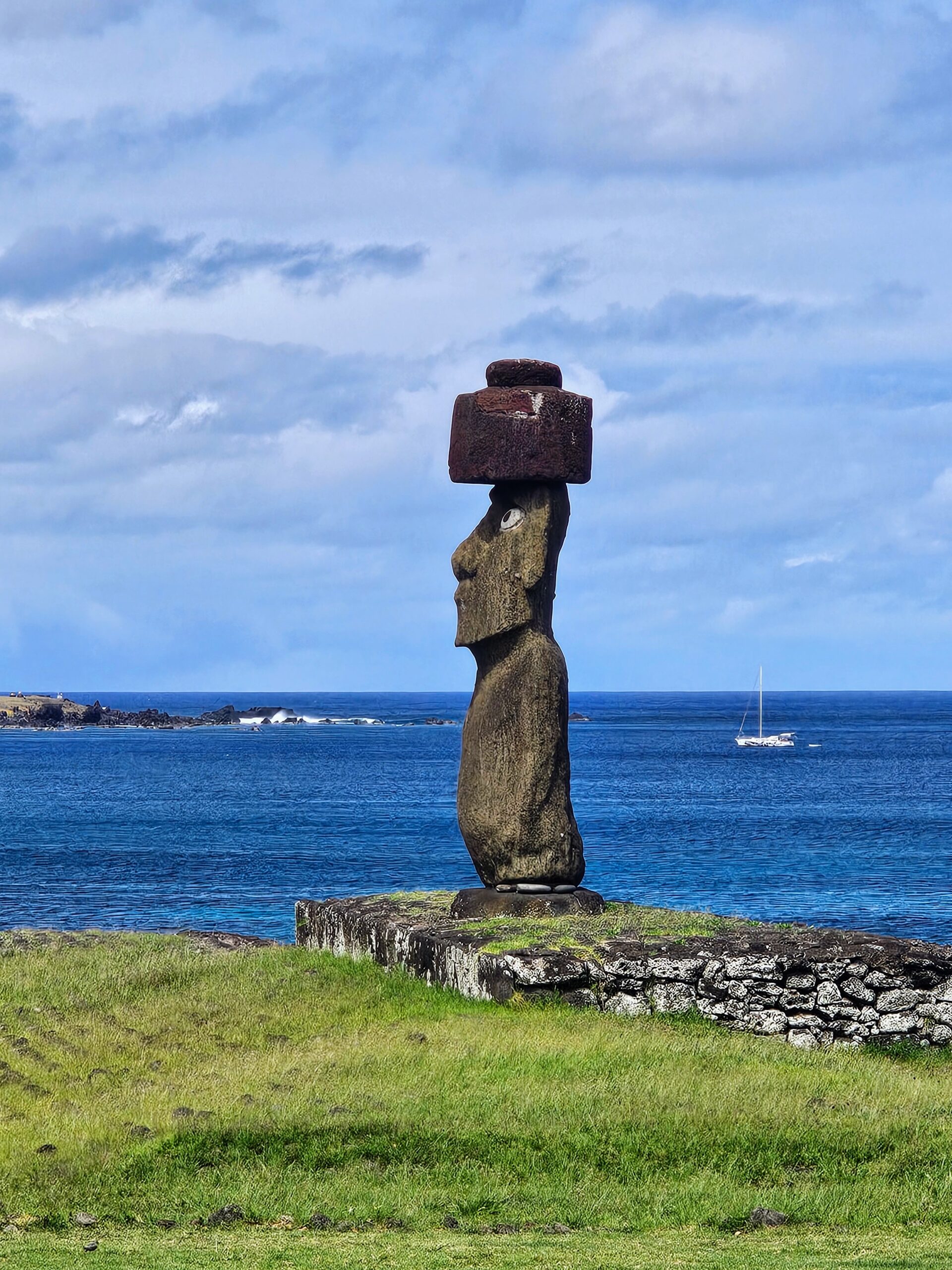
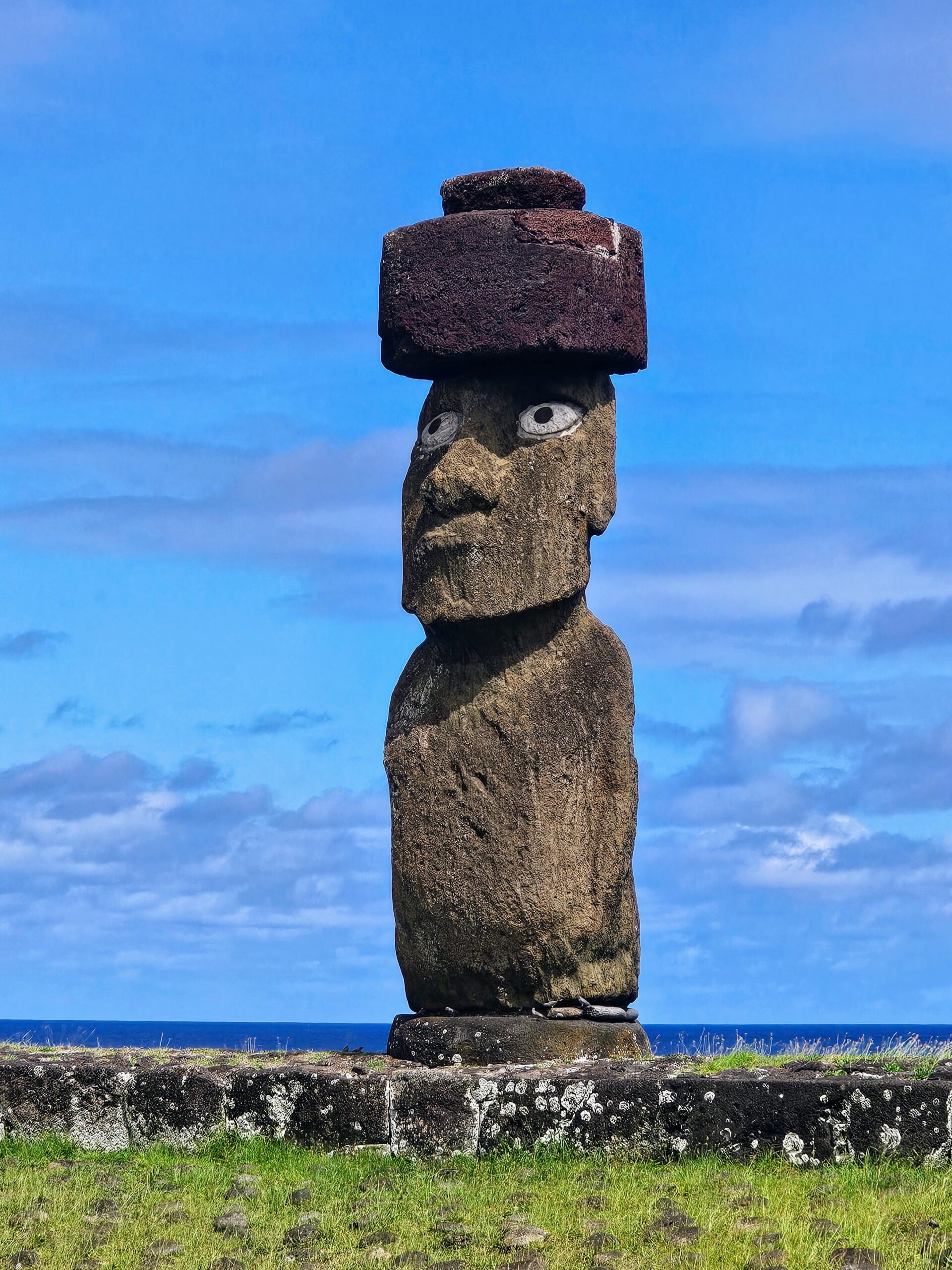
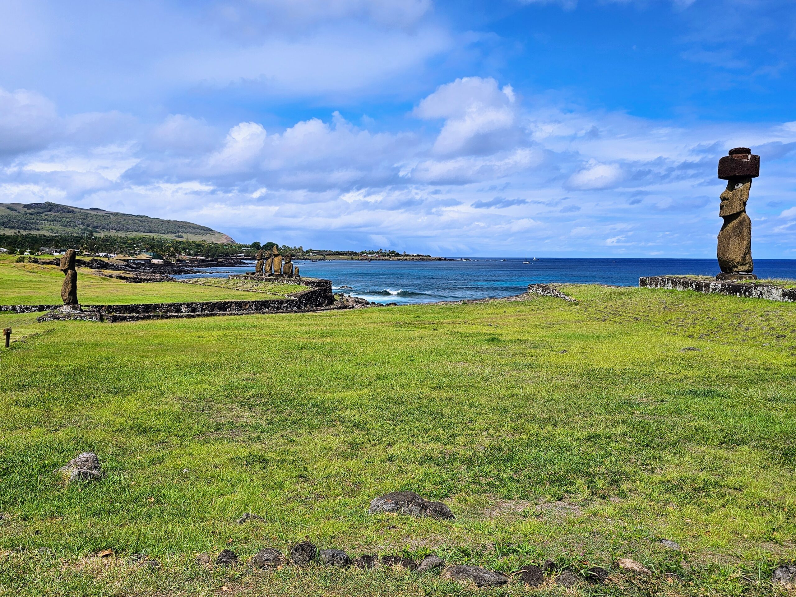
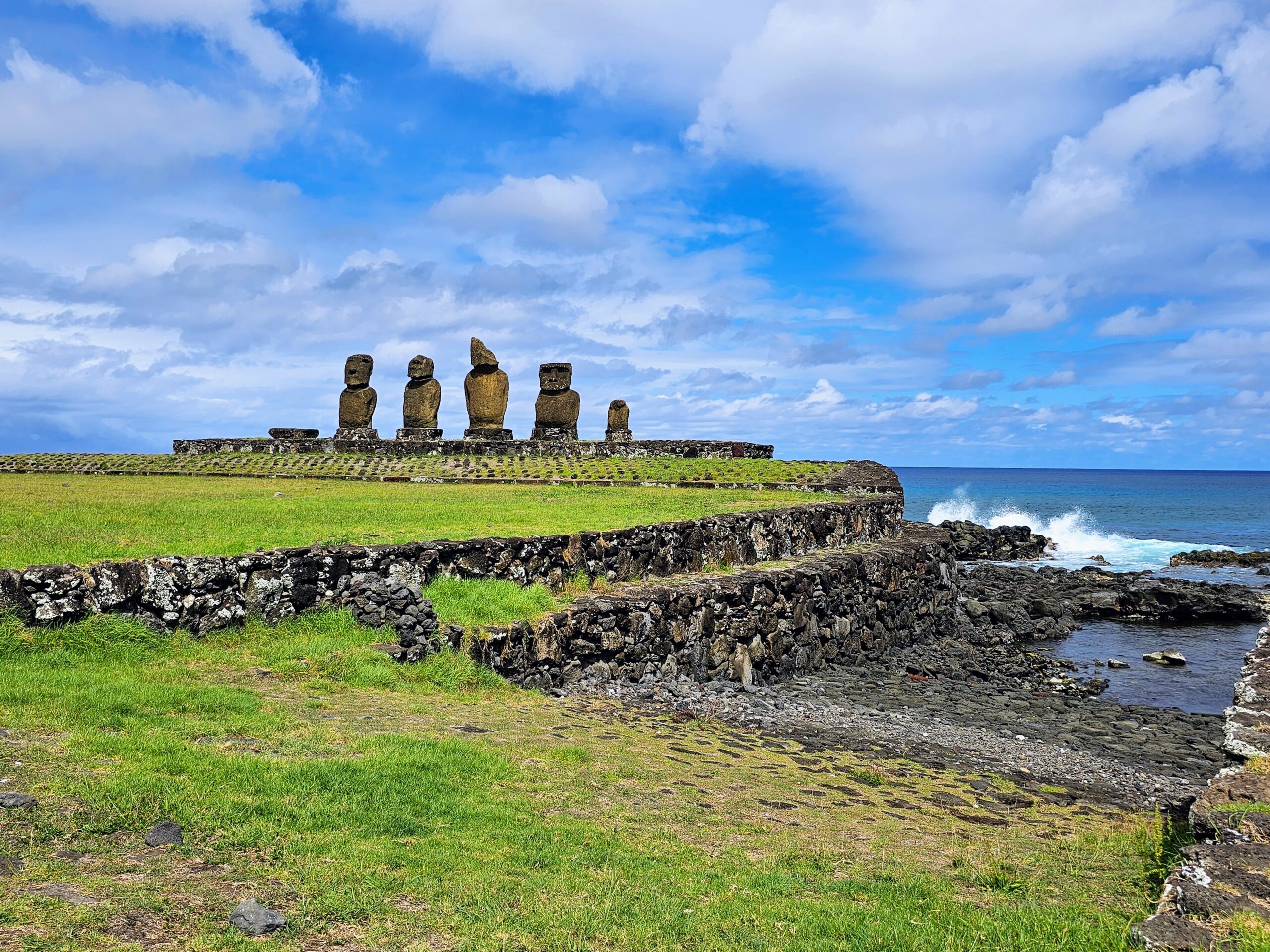
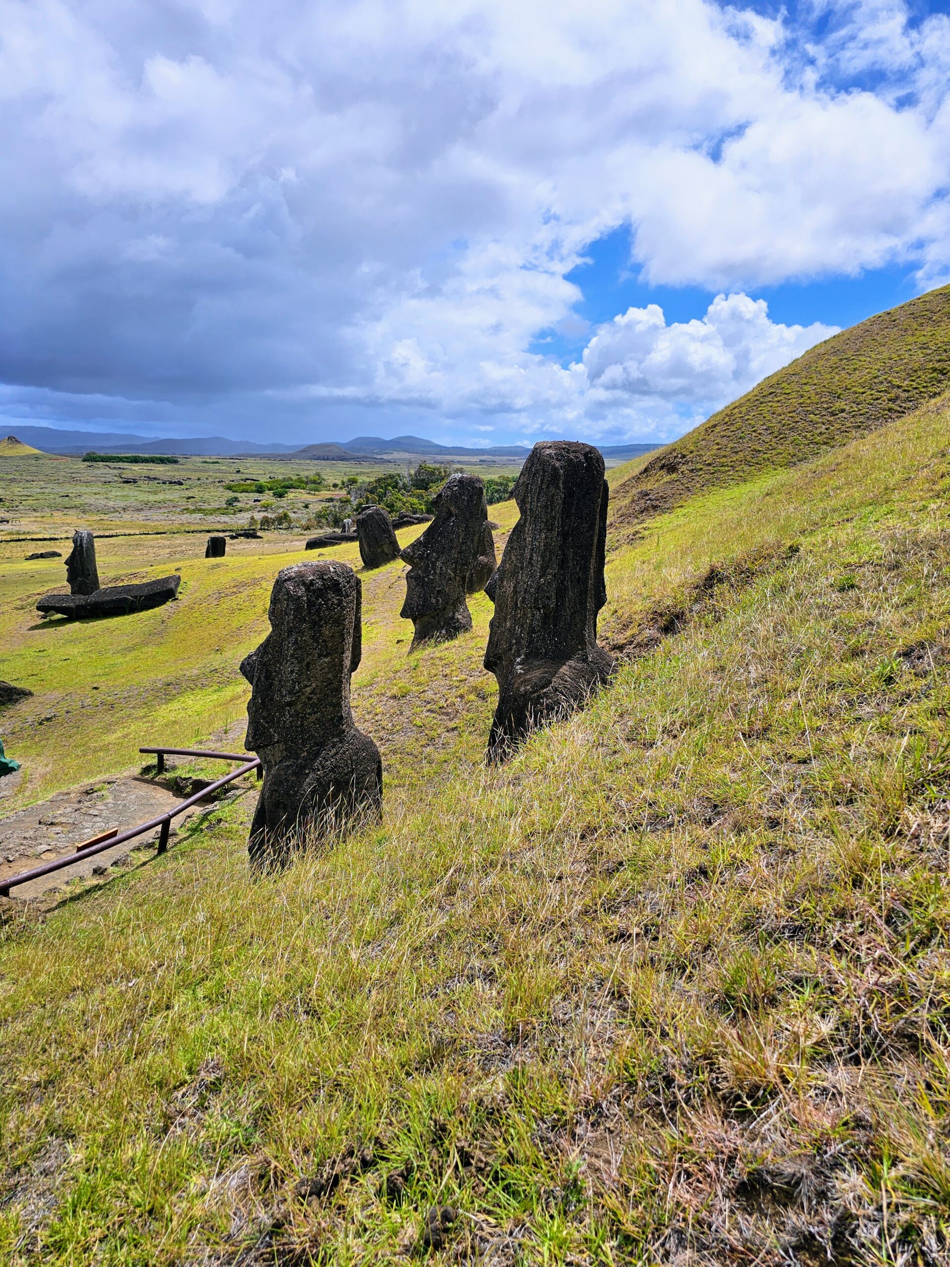
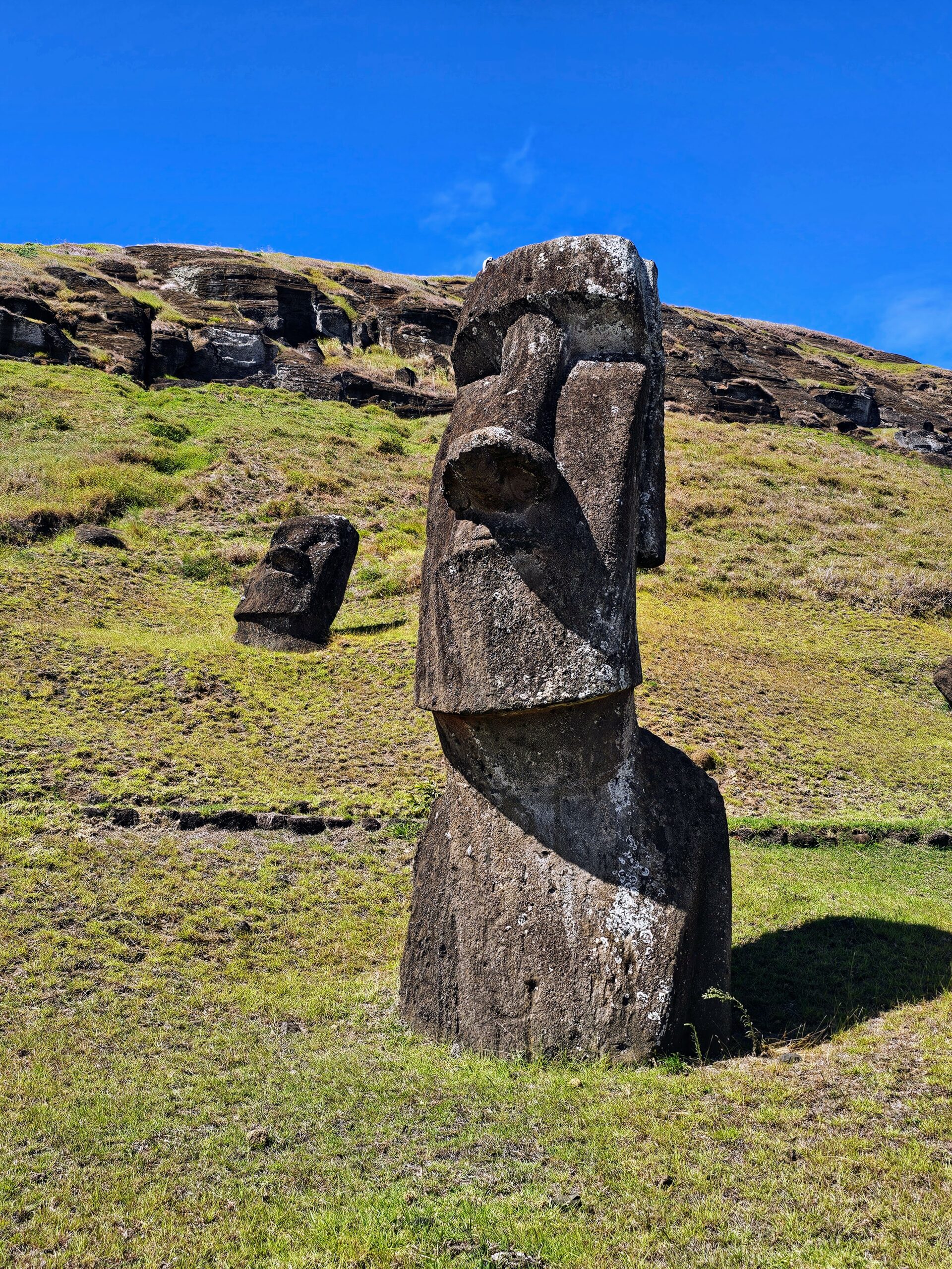
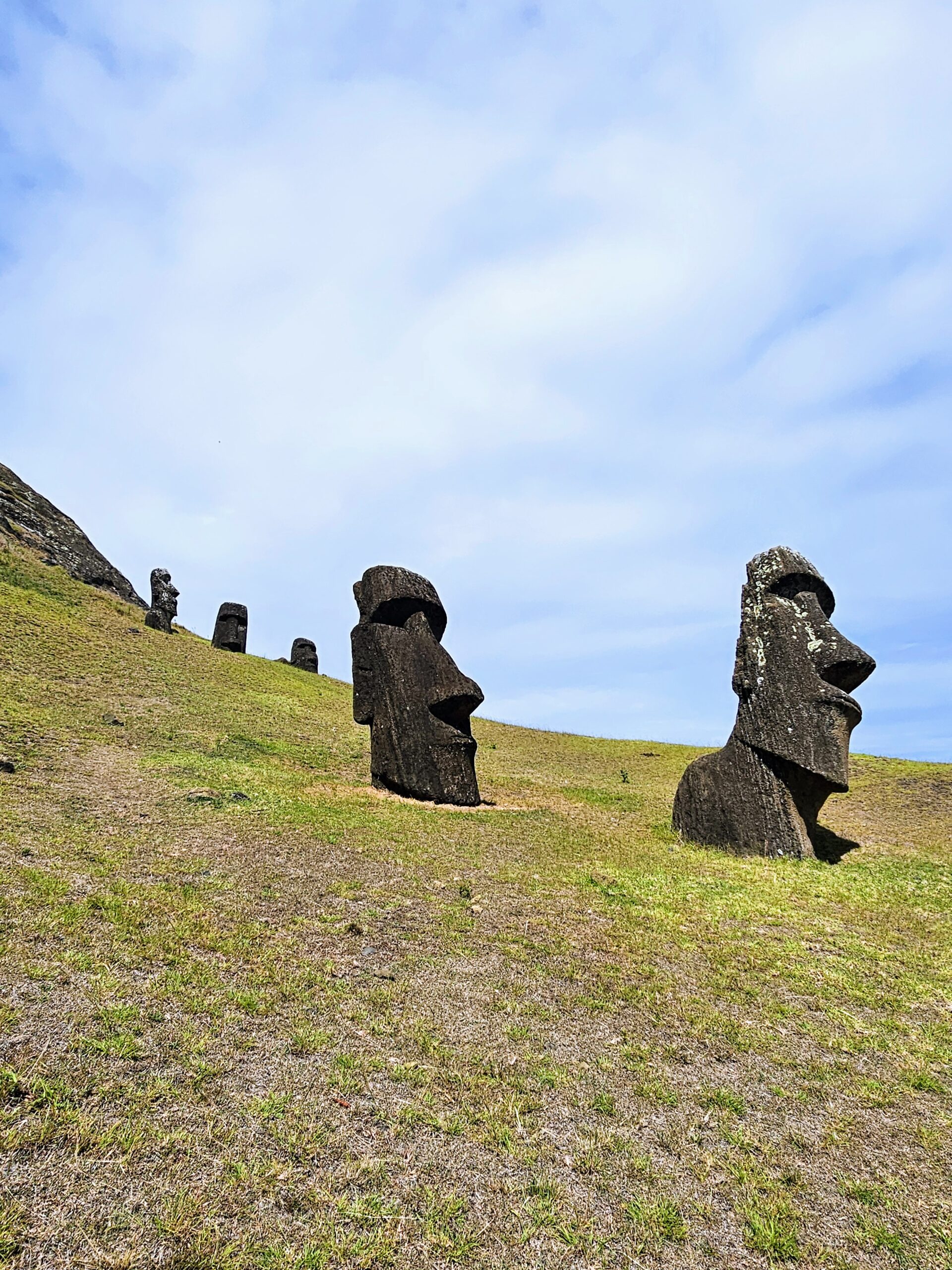
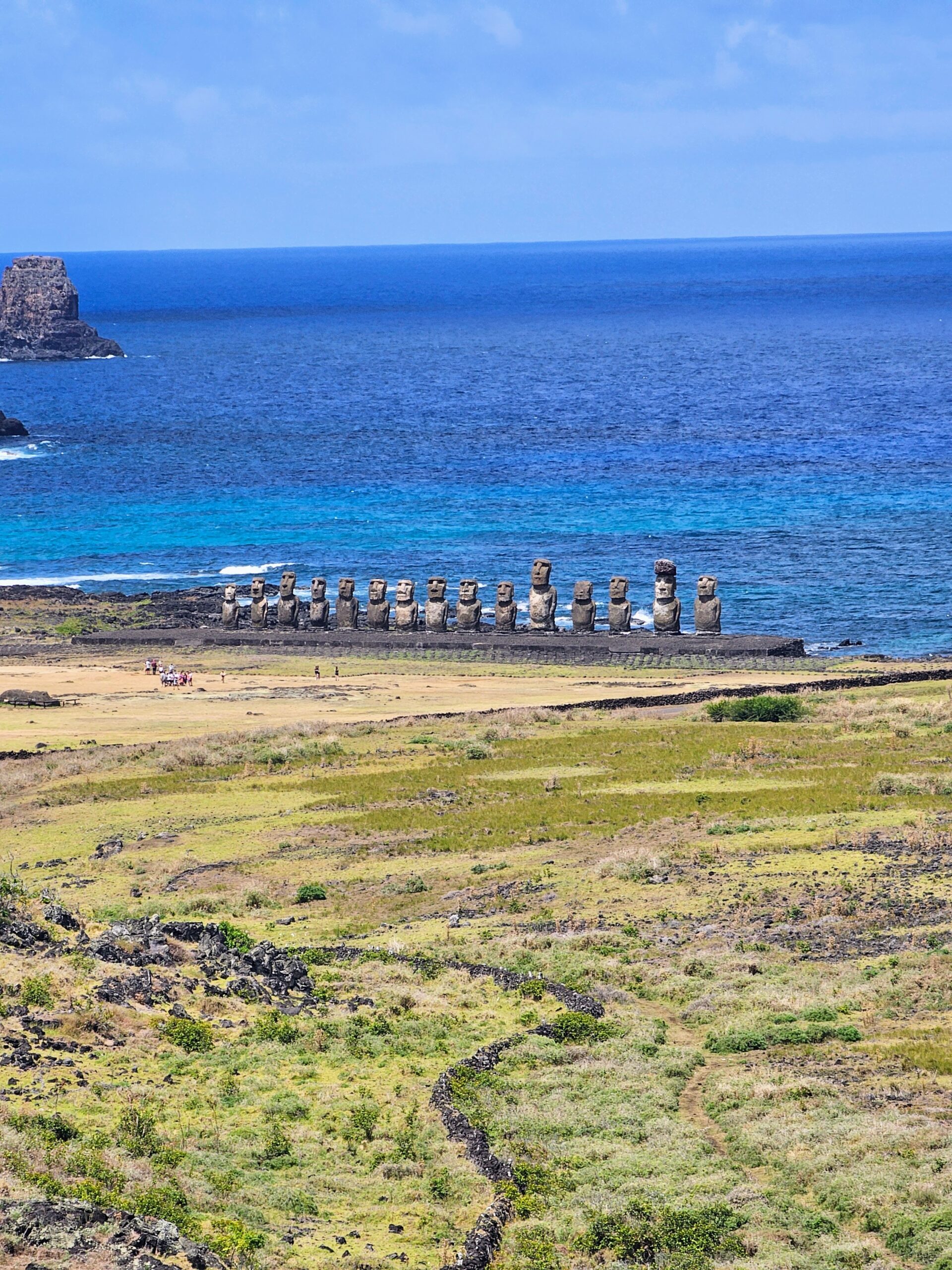
Our morning excursion culminated at yet another moai site, this one called Ahu Nau Nau.

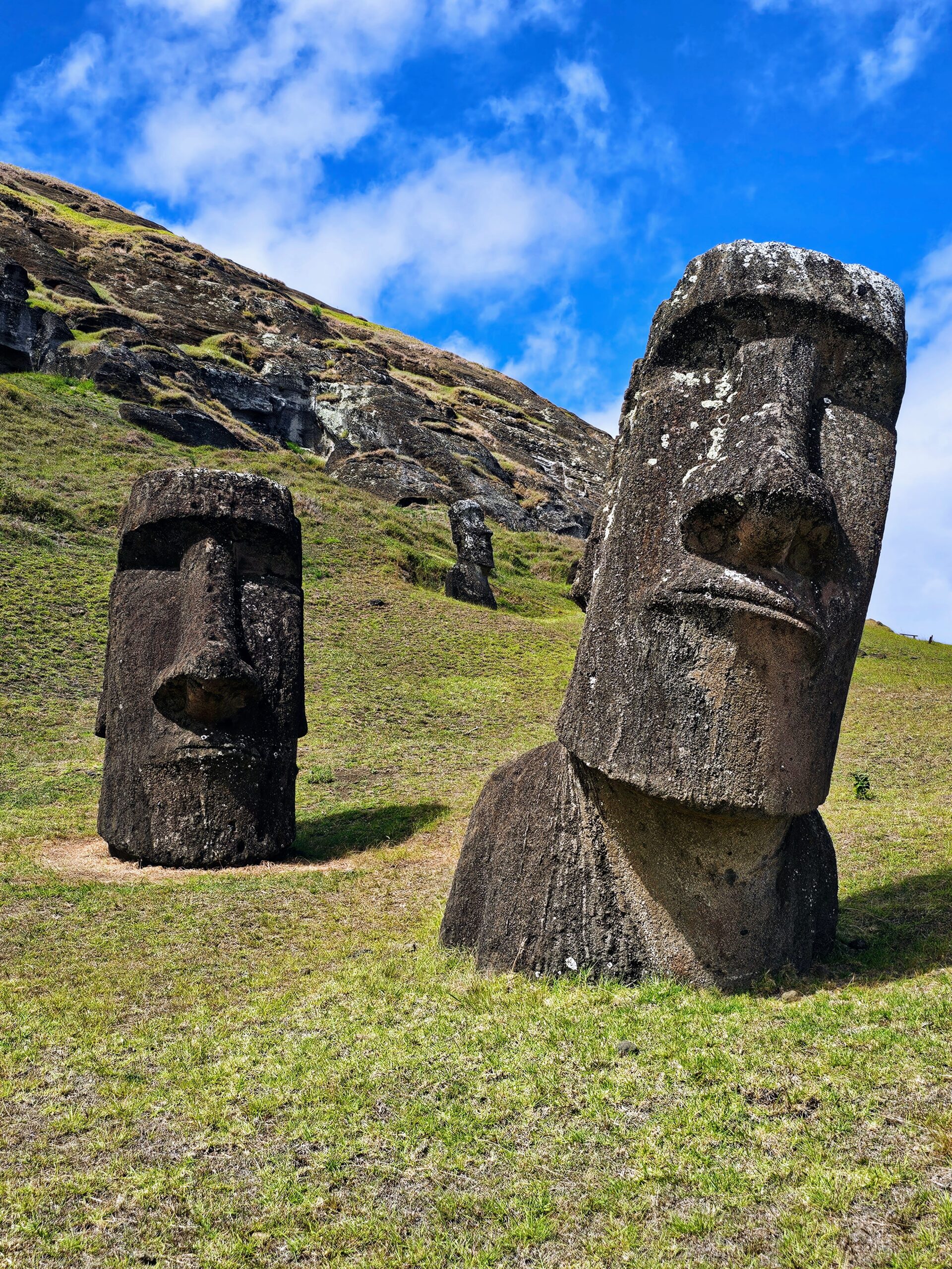
I’m not convinced the red rock is supposed to represent a topknot of hair. It looks like it represents a crown of some type to me. This photo allows you to easily see the hands on the moai. The leaders of the time supposedly had very long fingernails.

Another angle of the 7 moai with the palm trees in the background.

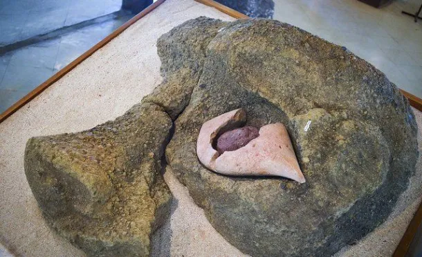
An important discovery was made among these moai during excavation work in 1978, this original eye made of coral. They would all look so different with these eyes!
This spot sits right on the ocean next to Rapa Nui’s best beach, Anakena. With fine white sand and a protected harbor, it’s a perfect spot for swimming. We headed to the beach and spent about 20 minutes in the water.

I didn’t get a photo from the beach, but here is one from the internet. I believe we set our towels down in the shade of the pictured palm tree. This beach is believed to be the landing spot of the first Polynesians to arrive.

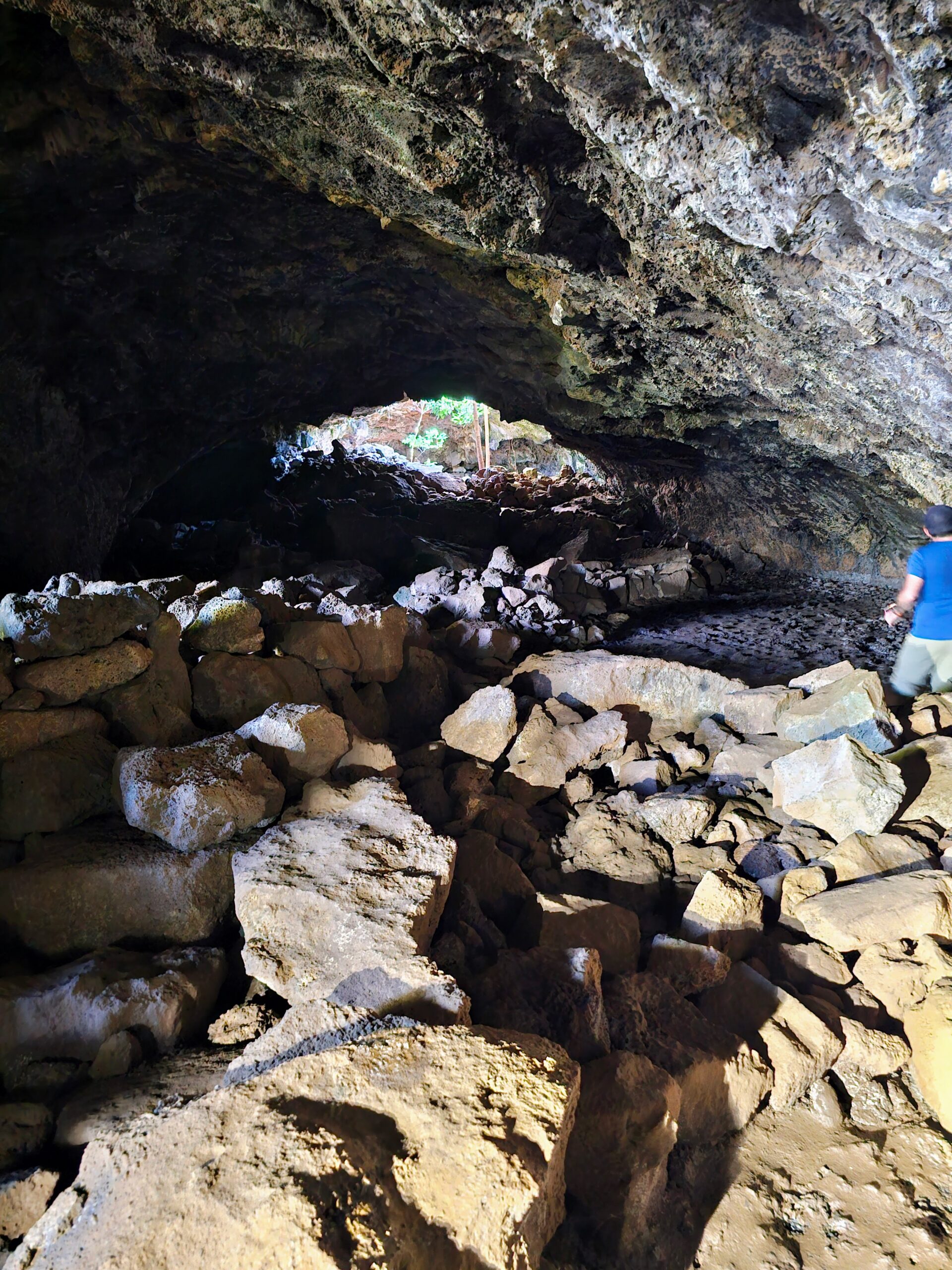
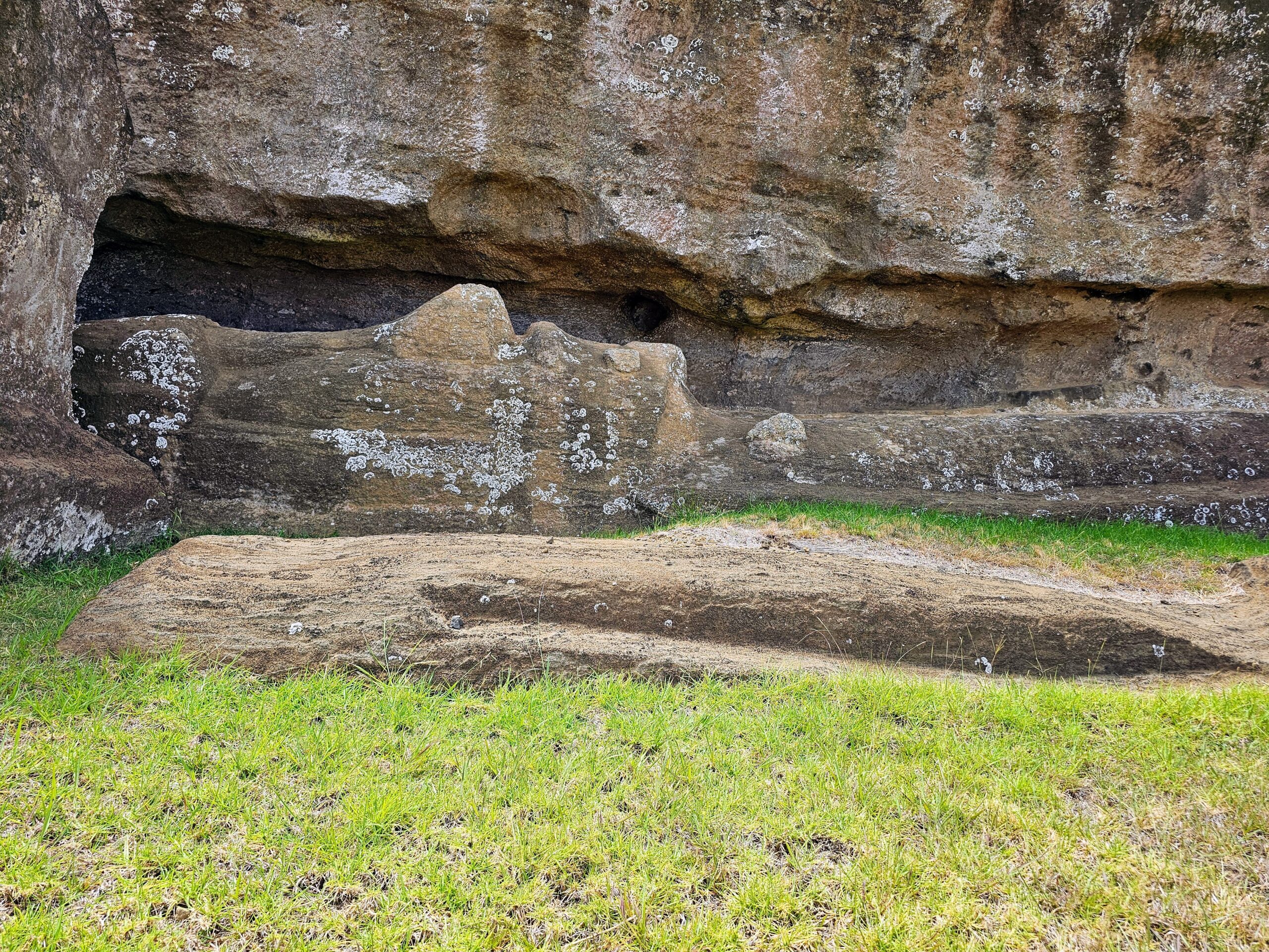
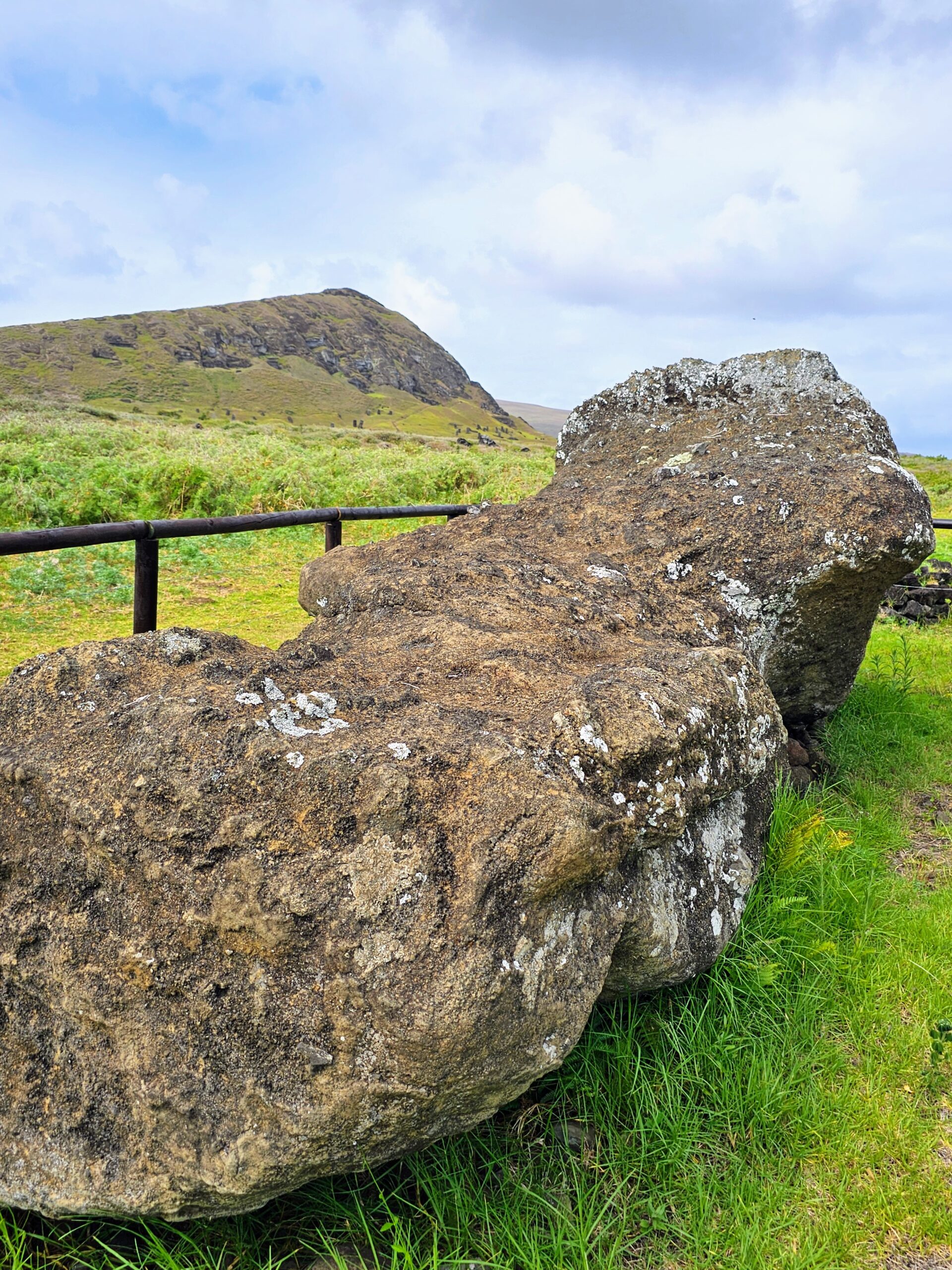
After another lunch back at the resort we embarked on our last excursion. First up was Vinapu, which unfortunately has nothing to do with wine. This moai site with an ahu has not been reconstructed at all.

The interesting part of this site is the ahu itself, with remarkable construction evident in the tight fitting stones.

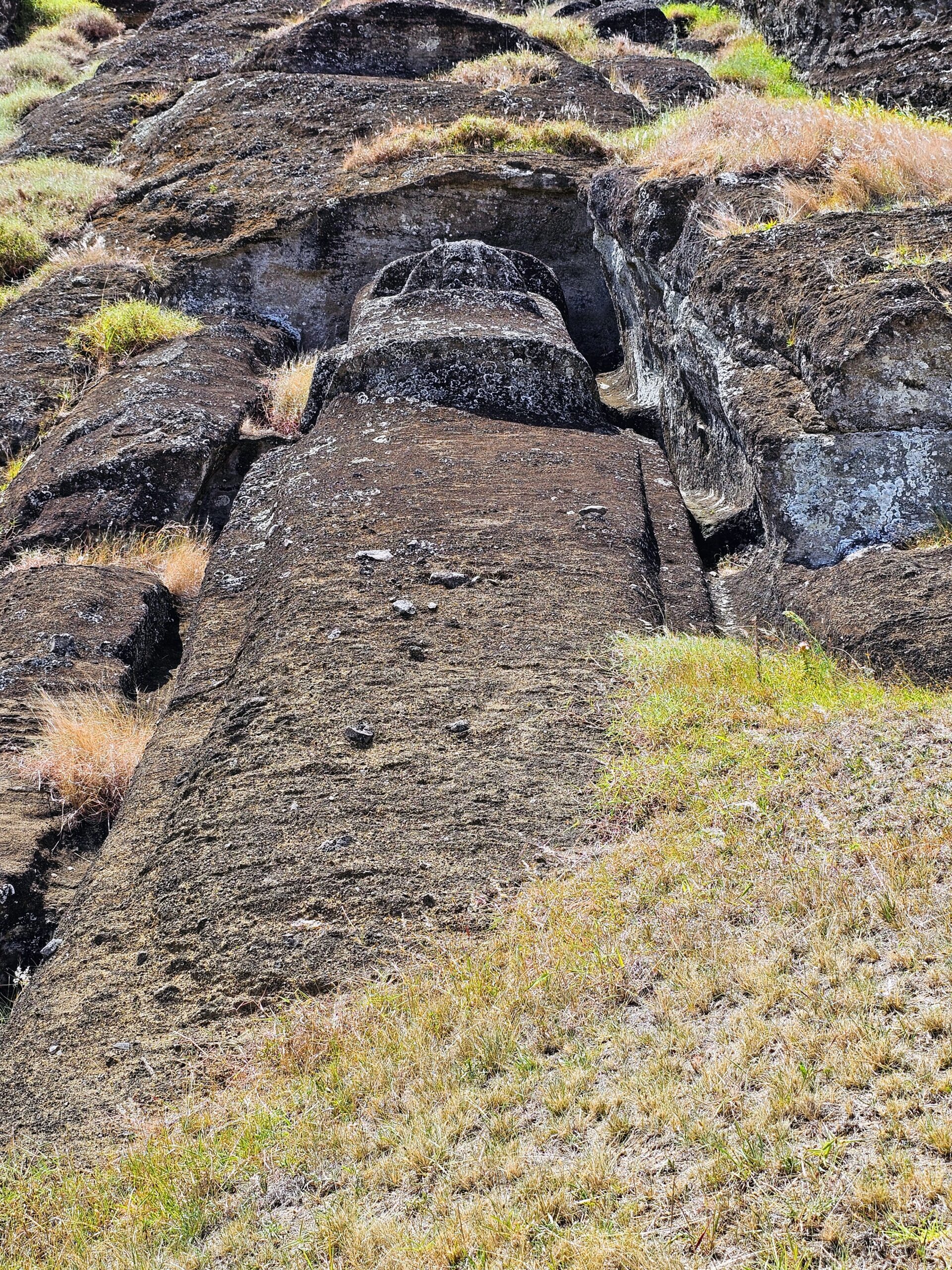
The moai here are in their original position since they were toppled.

Our guide pointed out this moai that is almost completely buried with just the face showing. Kinda creepy!

One last moai at this site that is supposed to be one of the few females represented. Somebody has even drawn a diagram in the dirt to suggest how you can tell it’s a female. Gotta be honest, just looks like a rock.

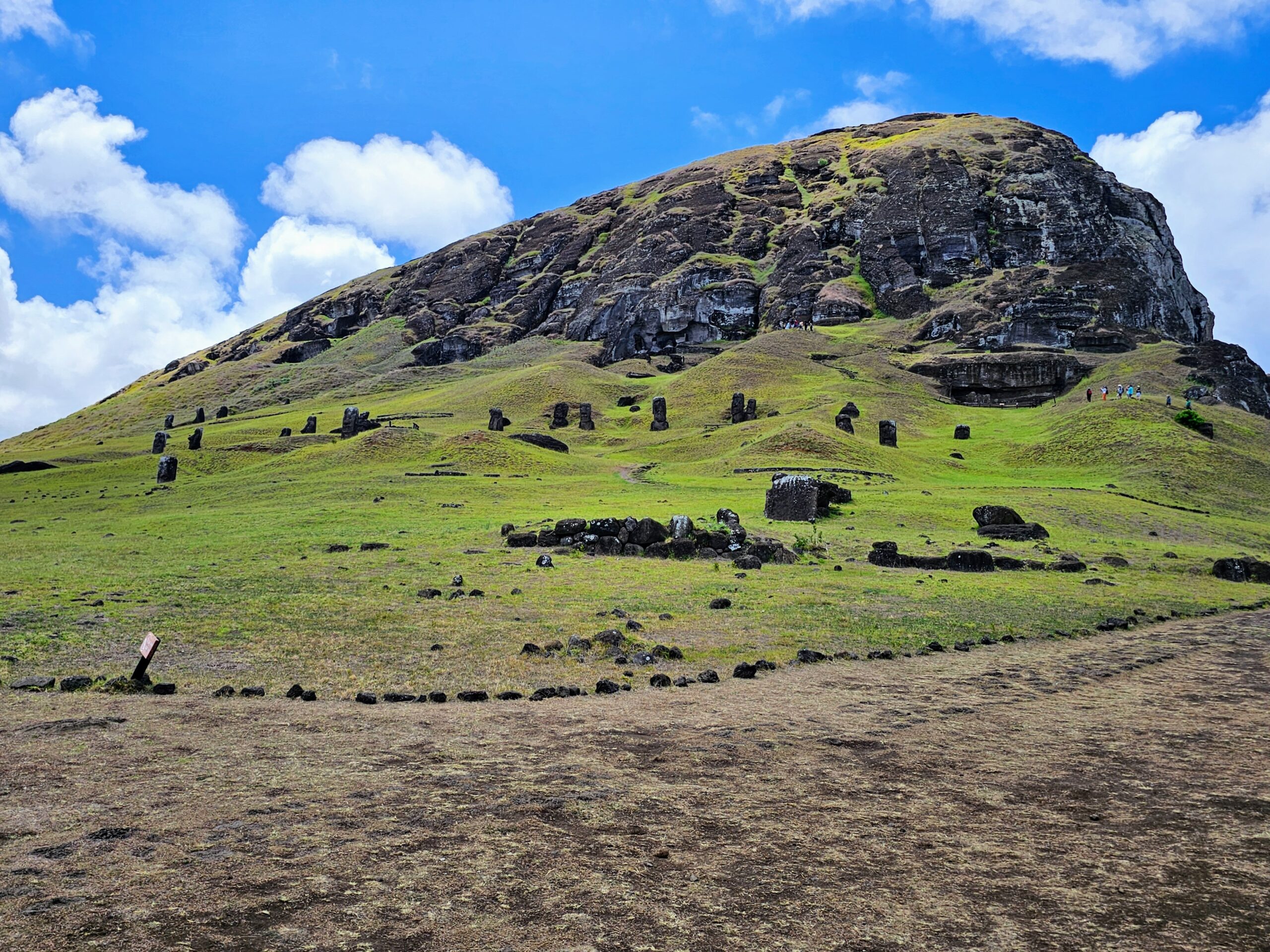
We then traveled up the side of Rapa Nui’s largest volcano, Rano Kau, to a spot where you can look into the crater. Rano Kau in the Rapa Nui language describes a “wide volcano filled with water”, which is quite fitting.

The views from the craters rim are excellent!

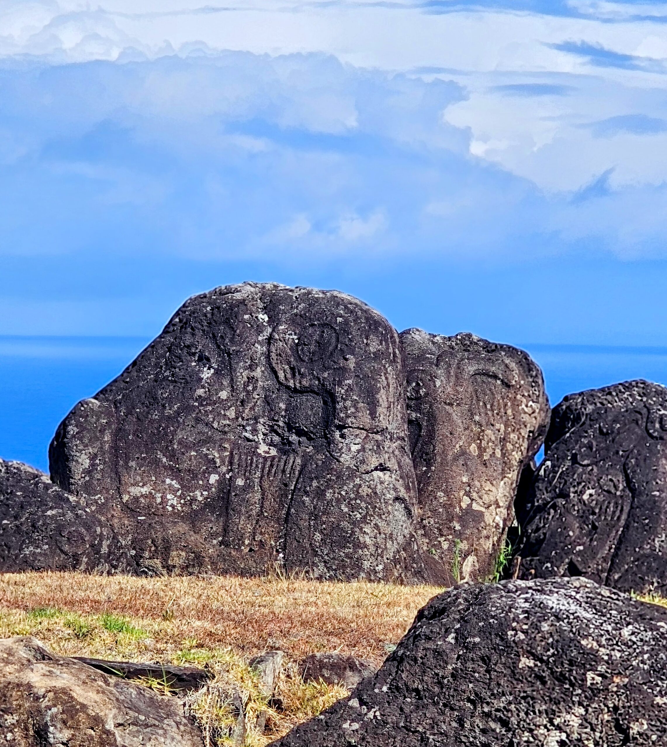
On the rim of the crater is a petroglyph which our guide asked us to guess what it is supposed to represent. My guess was a hitchhiking rabbit?
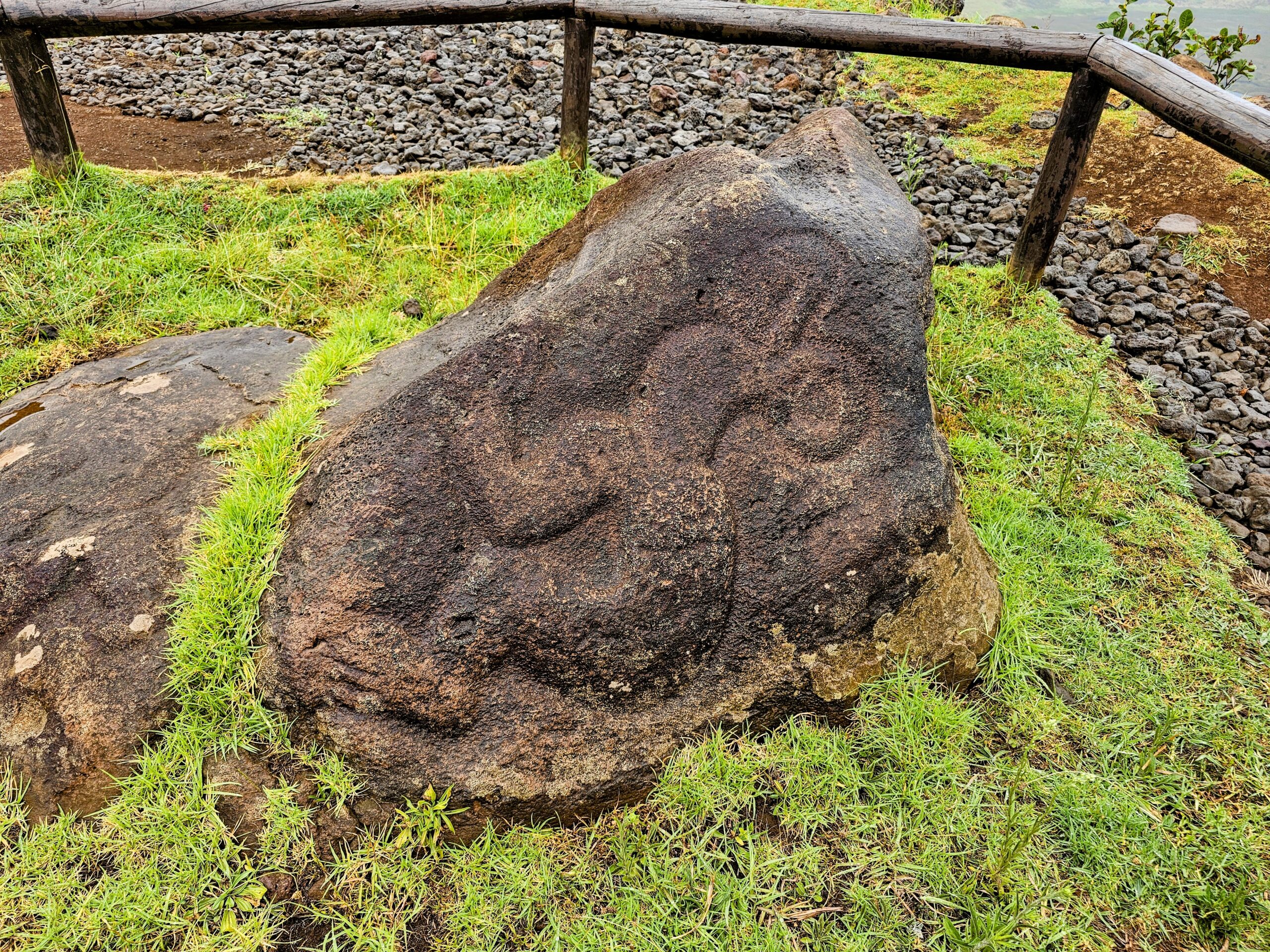
Below is an artists depiction of the petroglyph, which is known as the “Birdman”, a man with the head of a bird. The Birdman comes from a traditional ritual competition on Rapa Nui where each tribe assigned a member to swim to an adjacent islet to collect the first sooty tern egg of the season and then swim back and scale the volcanic cliffs to present it to the islands elders. The winning tribe would rule the island for the next year, and were entitled to gifts of food and other tributes from the losing tribes.

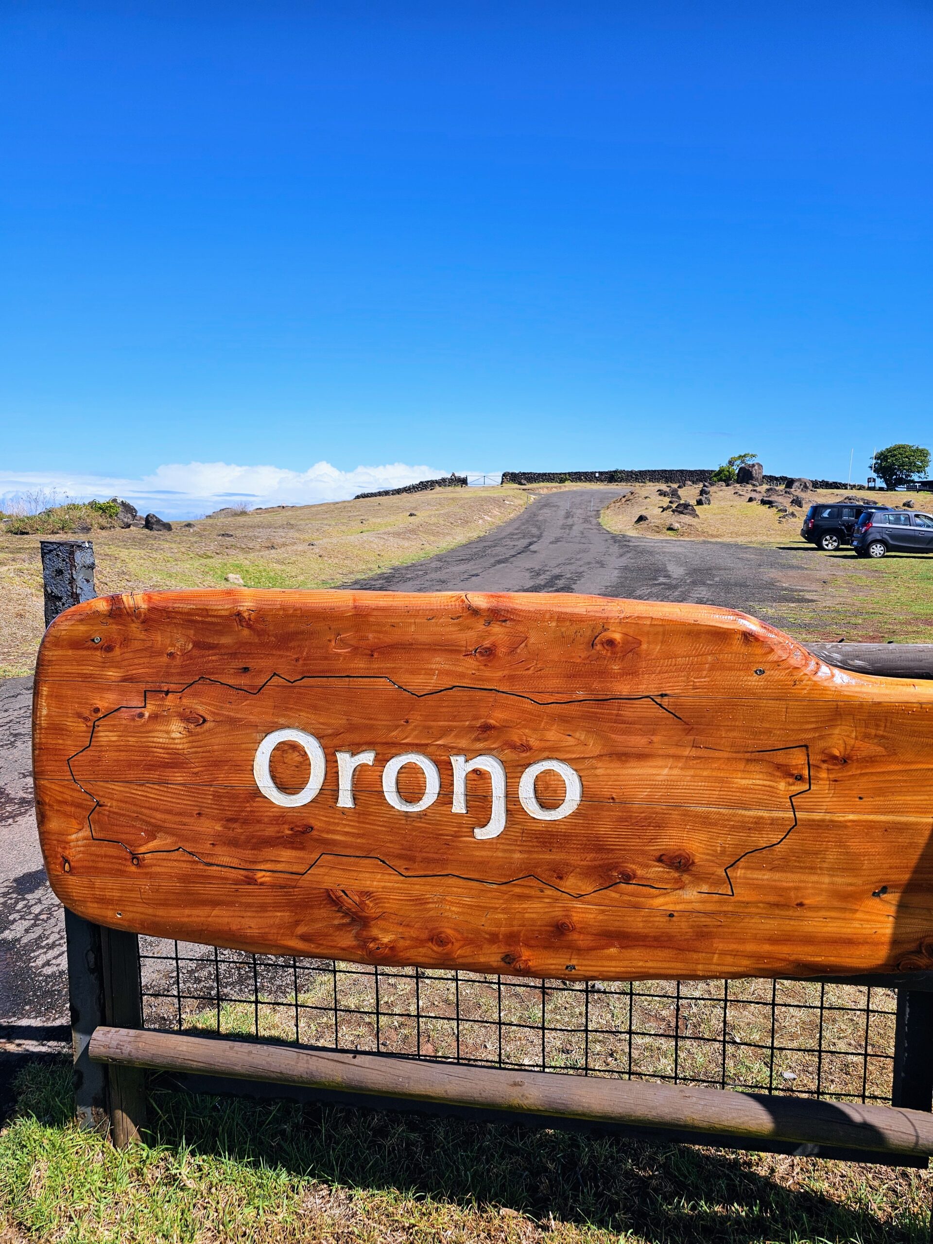
The competition started from the clifftop village called Orongo.
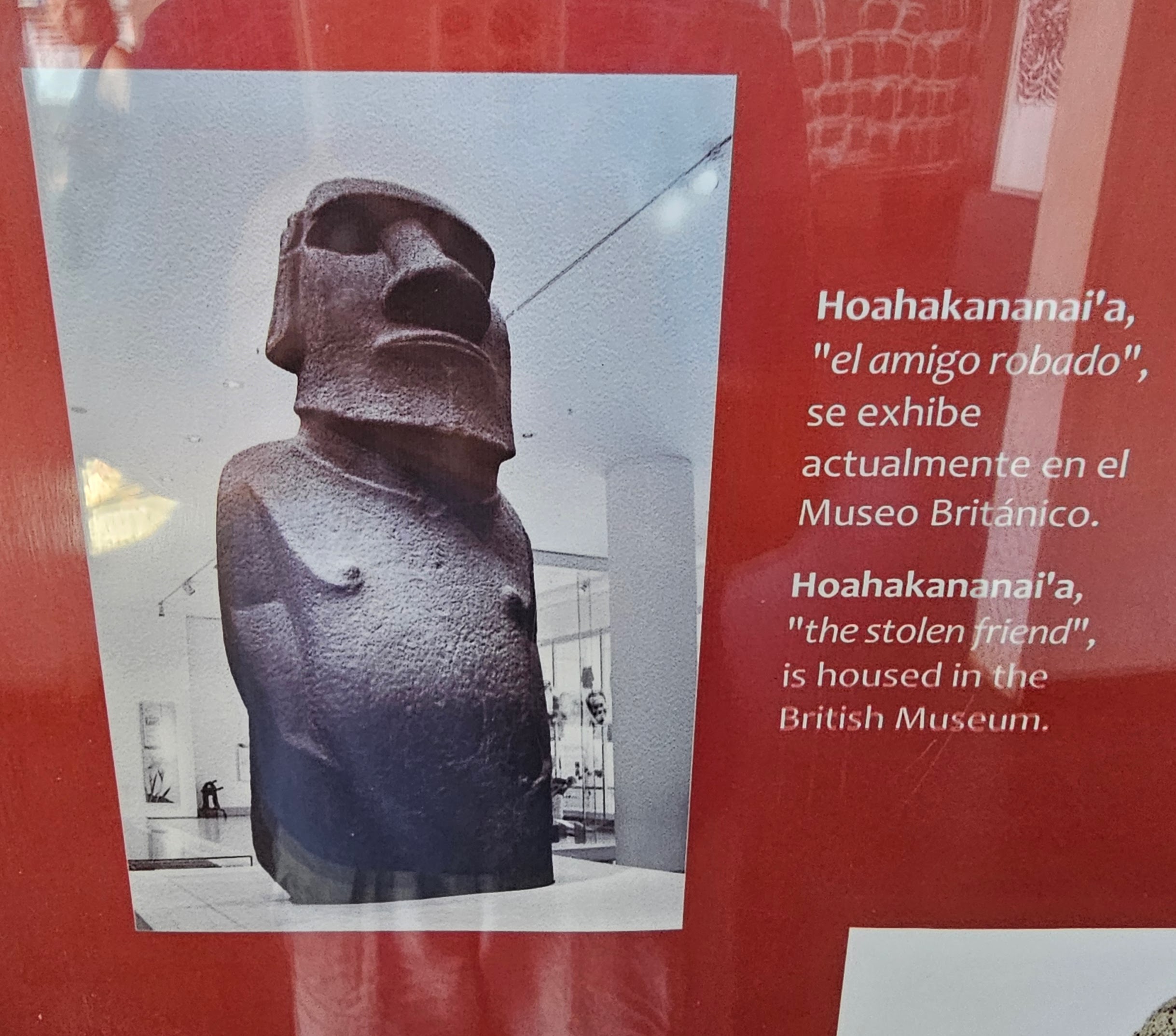
The site has a small visitor center that describes the history of the village and the Birdman competition. This photo shows a moai that was stolen by Britain in 1868 and is currently housed in the British Museum. It is considered a masterpiece and among the finest and best preserved moai ever created. Chile refers to this moai as “stolen friend” and has repeatedly called on the British to return the statue. I’m pretty sure we saw it there when we visited London a few years ago.
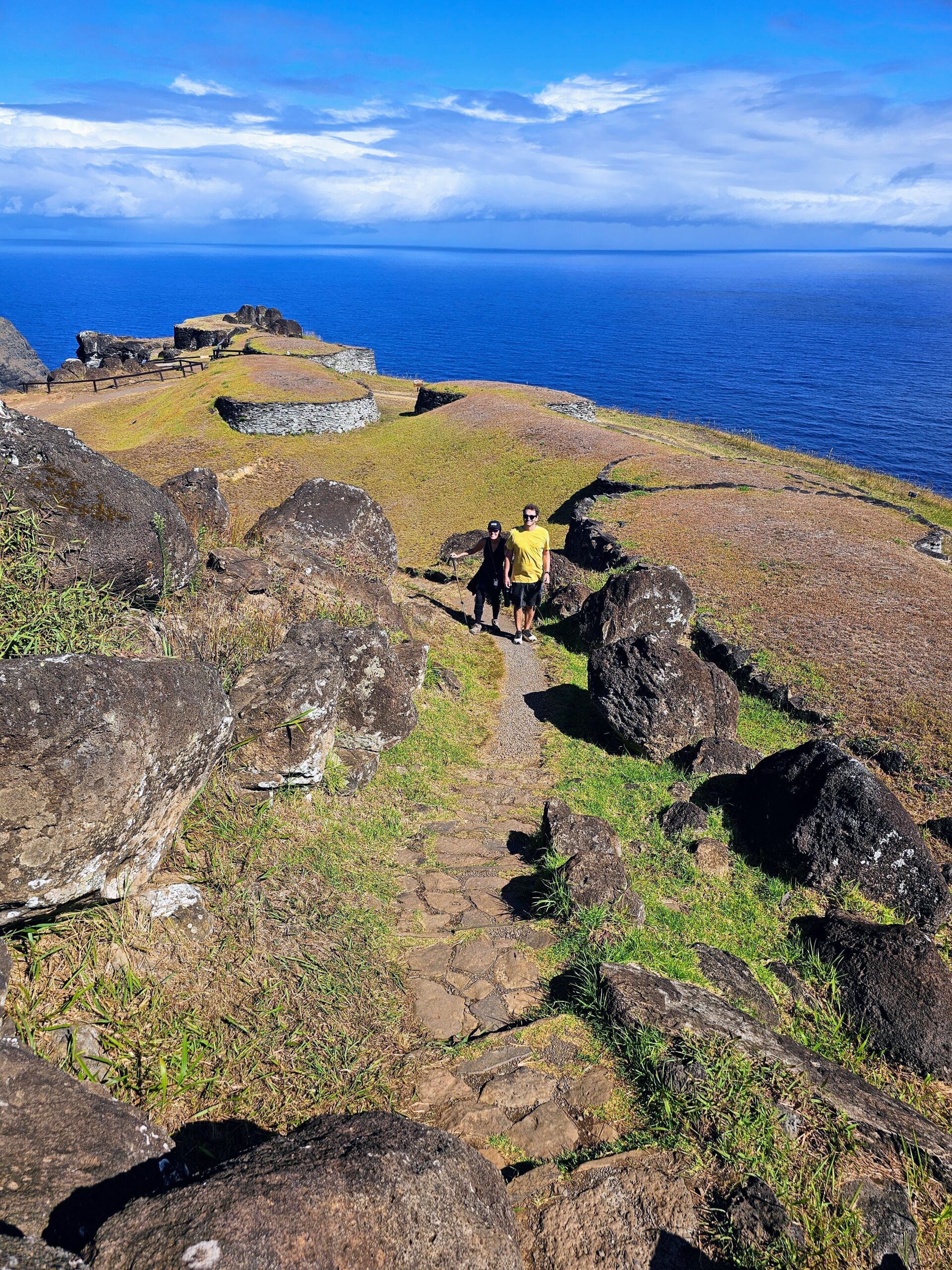
This house provides a good example of how the Rapa Nui built the rooftops of their villages. Orongo was not occupied full time, and was primarily used during the Birdman competition.

Despite not being used full time, the village is quite large. Each tribe would have their own building to house them during the competition, which could last for days. The entire village was restored in 1974, with sponsorship from UNESCO.

The buildings are all somewhat circular in nature with a sod roof.

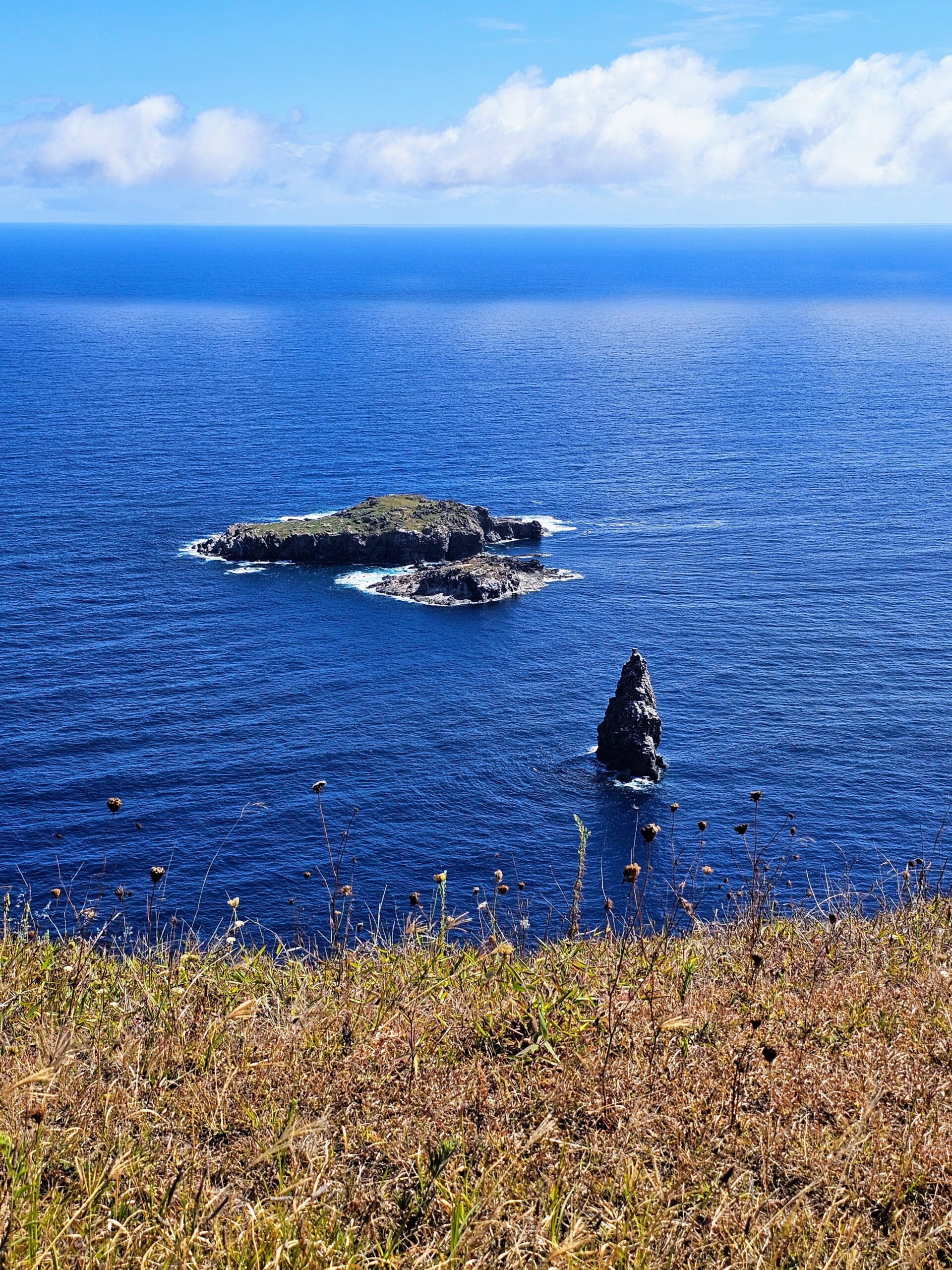
This photo is of the islet (called Motu Nui, furthest from shore) that the competitors swam to in order to collect the egg. The race was very dangerous, and many participants were killed by sharks, by drowning, or by falling from cliff faces, though replacements were apparently easily available.
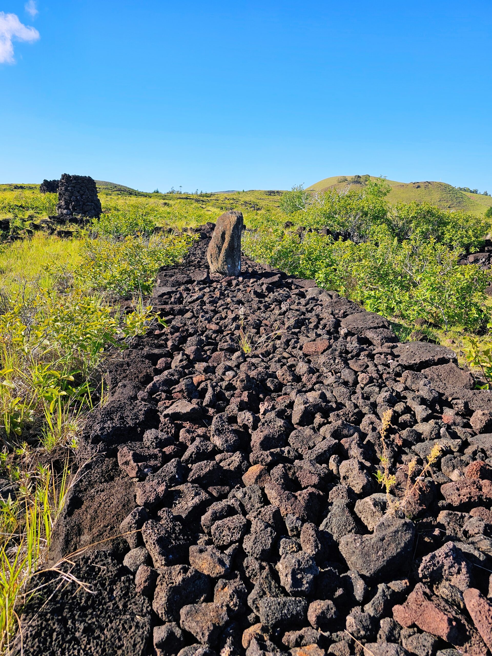
Directly adjacent to where the race would start is this petroglyph covered rock
One last look at the crater from Orongo.

As well as one last shot of Orongo. While it rained when we first arrived, it blew over quickly!
On our final morning we visited Hanga Roa, the only real town on Rapa Nui, and did some shopping. Let’s just say the best shopping was at the airport. Regardless, the town church is unique and worth a visit.

Even Jesus has a Rapa Nui vibe.

Our flight awaits!

One last shot of Rapa Nui. This was an awesome ending to an incredible vacation! Bucket list checked off!!

Thanks as always for reading. The highlights of the trip were the beginning and the end….the epic Iguazu Falls and the amazing cultural scenery of Easter Island! Definitely plan on visiting both at least once in your life!